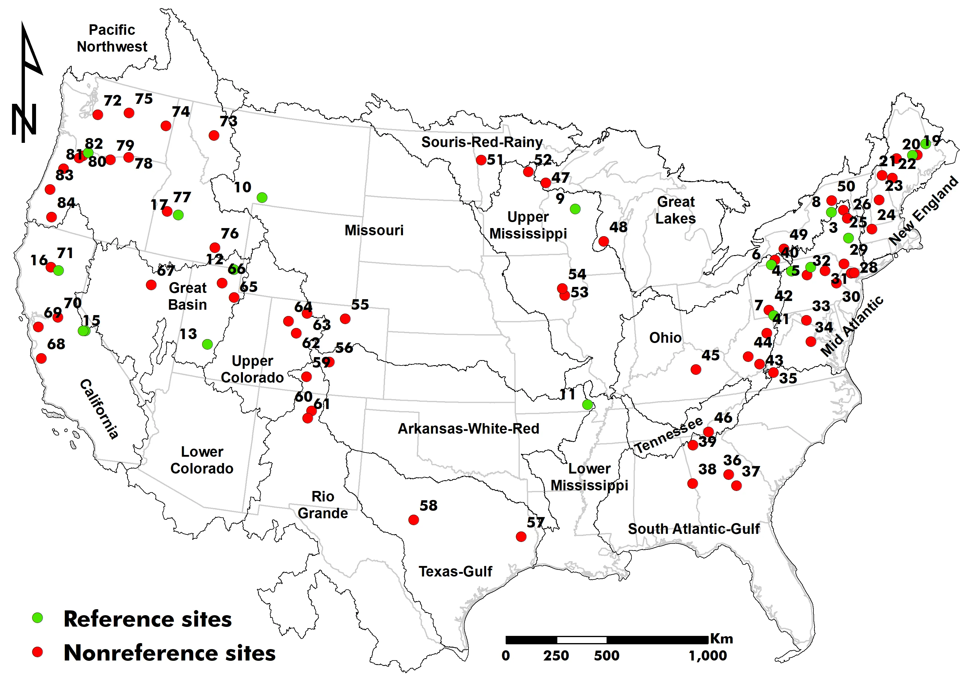
Precipitation, particularly at high quantiles, has been reported to increase in various regions across the globe, raising pluvial flood risk. One of the main challenges in reliable flood frequency analysis is handling nonstationarity arising from climate variability or anthropogenic disturbances such as land use/cover change or river regulation. To separate these nonstationary footprints, we analyzed annual maximum peak flow records from 18 reference (minimally disturbed) and 66 non-reference stream gages, each with more than 100 years of flood records across the United States. Next, we used a nonparametric Pettitt test to identify statistically significant change points. When present, the flood record was split into pre- and post-change segments with a Log-Pearson III distribution fitted to each. Depending on the region and site type, using a segmented record improved the quantile estimate. At the majority of reference sites, post-change data produced the highest flood quantiles, reflecting recent climate-driven nonstationarity. Conversely, at several non-reference sites, pre-change data returned larger estimates, indicating that long-standing anthropogenic disturbances can attenuate the signal of climatic variations. Our study confirms that fitting a flood frequency model to the segment that minimizes nonstationarity, rather than the entire record, returns more reliable estimates for moderate flood magnitudes of up to a 25-year return interval. The approach highlights the need to understand the population from which flood records are extracted, to separate those populations where appropriate, and then fit a statistical distribution. This practical approach offers a simple thought process for updating moderate flood forecasts to guide infrastructure design or rehabilitation in the current dynamic environment, an era of constant change that needs flexibility in everything we design.
Increasing monopile diameter significantly alters lateral load response, and traditional design methods have already demonstrated limitations, while the influence mechanism of the diameter effect is still not in consensus. Using the three-dimensional finite element simulation, which is validated against centrifuge test results, the influence mechanism of the diameter effect is analyzed, and the related failure modes are also examined. It is found that the lateral bearing capacity of the monopile increases significantly with increasing pile diameter. The interaction of the soil plug and soil around the pile can enhance the nonlinear characteristics of the lateral load-displacement response. As the pile diameter increases, the deformation response of the pile evolves from flexible through semi-rigid to rigid behavior, and distinct failure modes are also developed. With the increase of pile diameter, the depth range of the wedge failure zone for flexible piles increases gradually, whereas for rigid piles, the depth range remains essentially unchanged, but the radius of the rotational failure zone significantly expands. The depth range of the full flow failure zone of semi-rigid piles progressively shrinks with the reduction in pile bending deformation. Failure modes can significantly affect the initial stiffness of the p-y curve. The initial stiffness exhibits the dependence on the pile diameter, embedment depth, and failure mode simultaneously.
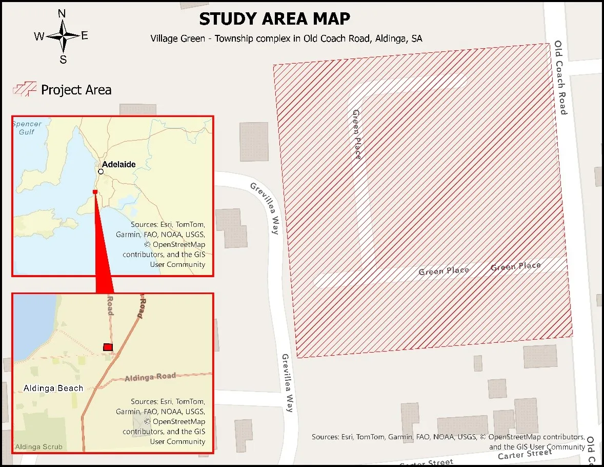
Urban stormwater runoff continues to challenge cities worldwide due to increasing impervious surfaces and intensified rainfall from climate change. Swales—vegetated conveyance channels designed to manage runoff volume and quality—offer a nature-based solution that integrates hydrological function, ecological enhancement, and cost-effectiveness. This study investigates the performance and lifecycle economics of swale systems using a case study in South Australia. A MUSICX model simulation was conducted to quantify pollutant removal and flow reduction, and lifecycle costing was performed to evaluate construction and annual maintenance requirements. Results indicate exceptionally high treatment efficiencies, with over 99% removal of total suspended solids, nitrogen, phosphorus, and gross pollutants, and a 99.09% reduction in runoff volume. The total capital cost of the swale network was estimated at $19,726.50, with annual maintenance at $6157.49. Economic benefits from pollutant removal and avoided downstream treatment were valued at $14,874 per year, demonstrating a favorable benefit-cost profile. The findings underscore the potential of well-designed swales to function as cost-effective, modular components of decentralized stormwater management systems. These results contribute evidence supporting the broader integration of swales into urban planning, particularly in water-sensitive design frameworks seeking to achieve sustainability, climate adaptation, and SDG-aligned outcomes.
With the development of hydraulic and hydroelectric projects, the connectivity of natural rivers has been disrupted, impeding the migration of migratory fish and affecting their reproduction and population sustainability. This study investigates a novel island-type fishway, where combinations of island structures and arc configurations dissipate water flow energy and reduce flow velocity, thereby minimizing resistance to upstream fish migration. The research focuses on the influence of island angles on the hydrodynamic characteristics within the island-type fishway. Experimental results indicate that low-velocity regions downstream of the island exhibit larger areas when the island angle is −60° or 60°. Meanwhile, at an island angle of 0°, the maximum flow velocity and the average flow velocity are reduced. Additionally, turbulence kinetic energy in the fishway chambers is effectively suppressed, with both maximum and average turbulence kinetic energy maintained at low levels. The water level variations caused by changes in island angles are minor, with an advantage observed when the island angle is set to 0°. These findings provide a reference for the further development of island-type fishways.