Found 1 results
Article
14 June 2023Spatio-temporal Evolution and Influencing Factors of Farmland Circulation Price at the County Level in China
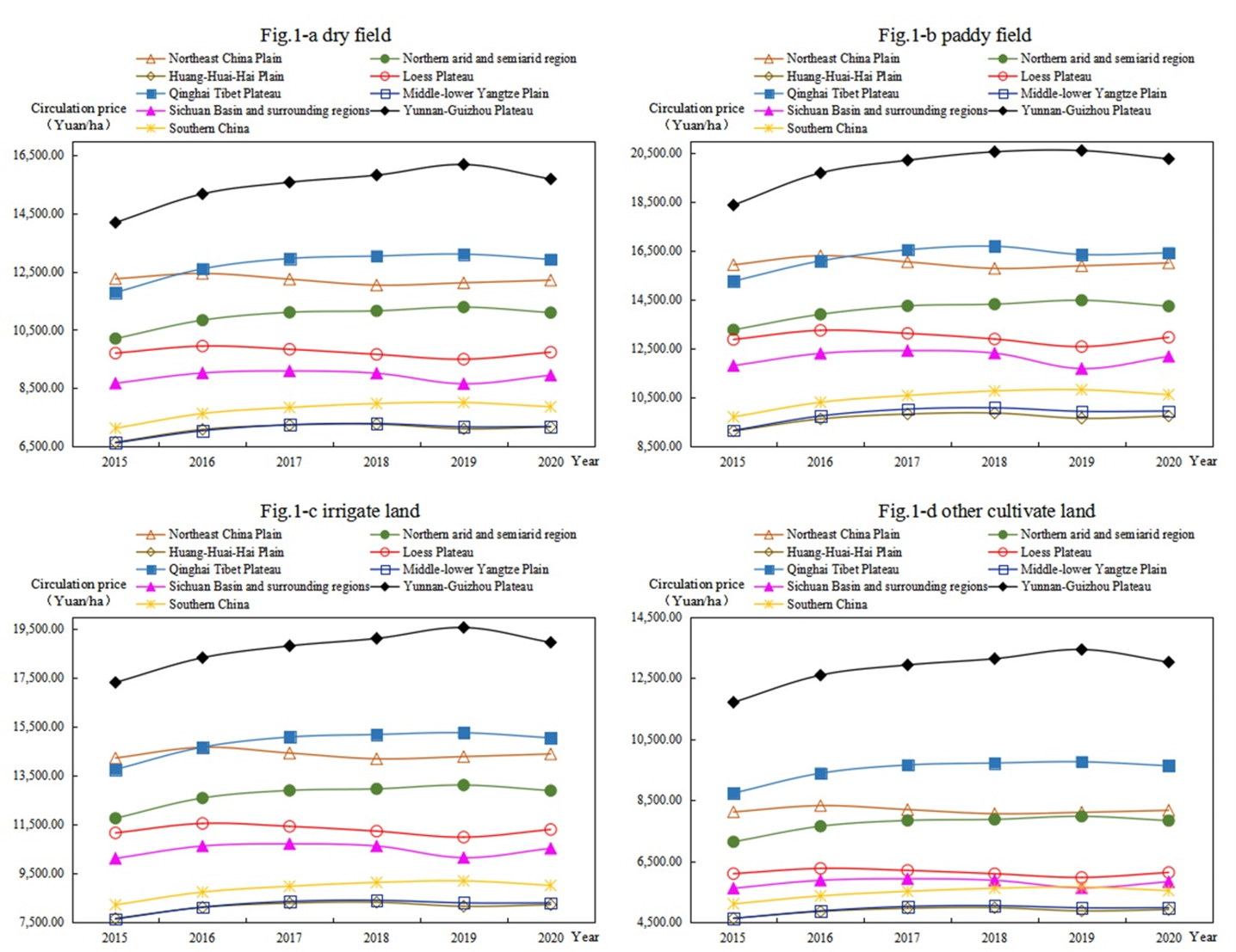
Farmland circulation is an important way to achieve moderate scale operation to ensure food security. Based on the spatial analysis and spatial econometric model, this paper studies the spatial-temporal evolution and influencing factors of cultivated land transfer price at the county level in China from 2015 to 2020. The results revealed the following: (1) the circulation price of farmland generally shows paddy field > irrigated land > dry land > other cultivated land. The farmland circulation price in Huang-Huai-Hai Plain is always the highest, whereas that in Qinghai–Tibet Plateau is always the lowest. (2) The spatial pattern of farmland circulation price is high in the south and low in the north, presenting an inverted U-shaped structure from east to west in 2015, and high in the east and low in the west, presenting an inverted U-shaped structure from north to south in 2020. Moreover, the spatial agglomeration was enhanced. (3) With the development of land market and urbanization, the restriction of natural factors of cultivated land on the farmland circulation price weakens, while the socio-economic attribute of cultivated land constantly strengthens. Based on the results, this paper puts forward some suggestions to prevent the overcapitalization of land.